Explore the phenology data and maps made available by the USA-NPN. Seasonal Stories guide you through several examples of ways you can visualize the data. The Data Explorer lets you dive deep into the observational plant and animal data as well as the USA-NPN's phenology maps.
Want a little guidance on how to use the the tool? Watch our Viz Tool Webinar recording.
In the Data Explorer, you can choose from several different types of visualizations and then select your area of interest, year, and species/phenophase.
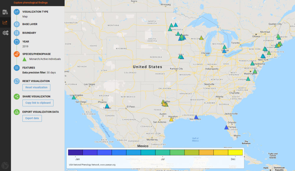
Map
Select a base map such as the Spring Index, Pheno Forecasts, or Daily Temperature Accumulations, or skip the base map and plot the start of plant and animal activity anywhere in the US. For select maps you can overlay observational data.
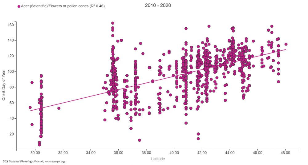
Scatter Plot
Compare the start of plant and animal activity to latitude, temperature, precipitation, AGDD, and other variables (see list below). Use the date slider to view a particular season of interest.
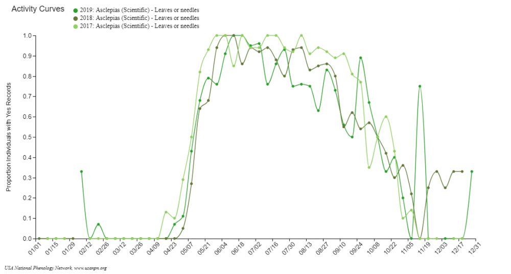
Activity Curve
View annual patterns in the timing and magnitude of plant and animal activity, based on proportion of “yes” records, animal abundances per hour and other metrics. Compare overlap of activity between species.
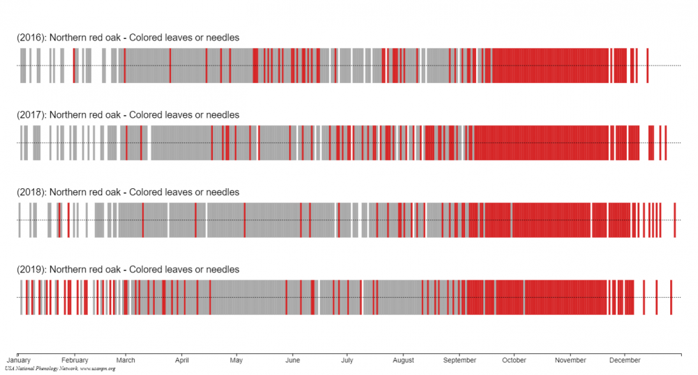
Calendar
View the annual timing of plant and animal activity for up to six years at a time. See "yes" and "no" reports for species of interest.
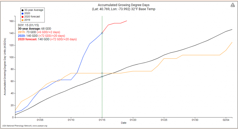
AGDD Time Series
See the amount of heat accumulated for your zip code this year, and compare it to last year and a 30-year average.
Scatter Plot Dependent Variable Definitions
Onset DOY: The first day of year (a calendar date between 1 and 366) that the phenophase was observed as occurring on an individual at a site.
Scatter Plot Independent Variable Definitions
Precipitation and temperature data (described below) are derived from Daymet.
Thornton, P.E., M.M. Thornton, B.W. Mayer, Y. Wei, R. Devarakonda, R.S. Vose, and R.B. Cook. 2016. Daymet: Daily Surface Weather Data on a 1-km Grid for North America, Version 3. ORNL DAAC, Oak Ridge, Tennessee, USA. Data set. Available on-line [http://daac.ornl.gov] from Oak Ridge National Laboratory Distributed Active Archive Center, Oak Ridge, Tennessee, USA. Date accessed: 2015/06/01-Present. Temporal range: 2008/01/01-present. Spatial range: N=52.00, S=14.53.DD, E=52.95, W=131.10. http://dx.doi.org/10.3334/ORNLDAAC/1328.
Latitude: The latitude of the site at which the target individual and phenophase was observed.
Longitude: The longitude of the site at which the target individual and phenophase was observed.
Elevation (m): The elevation of the site at which the target individual and phenophase was observed.
Year: Year of the Onset DOY.
Precip Fall (mm): Accumulated precipitation for the previous year's fall season, relative to the year of the Onset DOY (September-November).
Precip Spring (mm): Accumulated precipitation for the year of Onset DOY spring season (March-May).
Precip Summer (mm): Accumulated precipitation for the year of Onset DOY summer season (June-August).
Precip Winter (mm): Accumulated precipitation for year of Onset DOY winter season (December of previous year-February of onset DOY year).
Tmax Fall (oC): Average maximum temperature for the previous year's fall season, relative to the year of the onset DOY (September-November).
Tmax Spring (oC): Average maximum temperature for the year of Onset DOY spring season (March-May).
Tmax Summer (oC): Average maximum temperature for the year of onset DOY summer season (June-August).
Tmax Winter (oC): Average maximum temperature for the year of Onset DOY winter season (December of previous year-February of onset DOY year).
Tmin Fall (oC): Average minimum temperature for the previous year's fall season, relative to the year of the Onset DOY (September-November).
Tmin Spring (oC): Average minimum temperature for the year of Onset DOY spring season (March-May).
Tmin Summer (oC): Average minimum temperature for the year of Onset DOY summer season (June-August).
Tmin Winter (oC): Average minimum temperature for the year of Onset DOY winter season (December of previous year-February of onset DOY year).
Daylength (s): Number of seconds of daylight for Onset DOY.
Accumulated Precip (mm): Accumulated precipitation for the Onset DOY, beginning January 1st.
GDD: Growing Degree Days, i.e. accumulated maximum temperature when (Tmax+Tmin)/2 > 0oC for Onset DOY.
